An extremely powerful early Fall weather system is brewing and will begin developing as early as tomorrow. A strong low pressure system induced by a strong polar vortex will merge and morph with a disturbance coming out of the Gulf of Mexico. This disturbance moving North out of the Gulf of Mexico will bring an abundant amount of moisture with it. As the warm and moist tropical air moves North, the warm and moist air (latent heat release) will help strengthen the morphed weather system as it travels North along the Spine of the Appalachian Mountains.
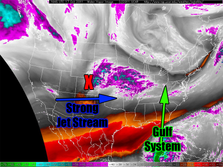
The water vapor imagery essentially tells the story this evening. You can see the large area of disturbed weather across portions of the Gulf of Mexico. The second system that will be a factor in this eventual large and phased weather system is a developing weather system across portions of Colorado. The extremely dry air across portions of Arizona and New Mexico is associated with our third player in this developing storm system and that is a very strong jet stream.
Nearly all of our forecast guidance has locked on to a solution of a strong weather system developing and moving into portions of the Midwest and Eastern Ohio Valley.
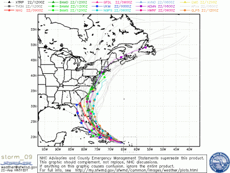
As the weather system begins to develop along the East Coast on Tuesday, strong and severe storms will be possible across the Southeastern United States. Increasing shear and an extremely tropical and buoyant atmosphere will lead to the threat of tornadoes from Florida into Georgia and eventually South Carolina.
This strengthening weather system will bomb out across portions of the Eastern Ohio Valley, strengthening possibly to as low or near 980 mb. This type of track is rare, as most storms that develop in this manner have a coastal low that transfers off the Mid Atlantic coast and tracks up the Northeast coast verses strengthening over land.
The track of his system means that a very large area will be impacted with heavy rain occurring from Florida all the way up the Appalachians, through the Ohio Valley and into portions of the Interior Northeast.
As the system reaches it’s peak intensity over the Eastern Ohio Valley and Eastern Great Lake states Wednesday and Thursday, extremely strong winds are also possible. You can see the tight wind field noted by the extremely close isobars around the low pressure.
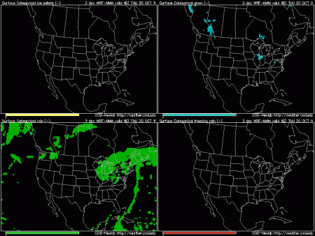
With extremely impressive height falls as the low pressure deepens, it is not out of the question that some light snow could fall across portions of Northern Illinois, Southern and Eastern Wisconsin, Northern and Northwestern Indiana and Western Michigan. Obviously with extremely warm ground temperatures and fairly warm lower and mid level temperatures, no accumulation would occur, but the fact that some wet snowflakes are possible is definitely impressive.
Stay tuned to our facebook page for the latest on this developing storm system over the next 24-48 hours (www.Facebook.com/SWATChasers).


 Posted by swatchasers

